2.1 What is an MCS?


Click the image above to view animation.
Convective storms appear in many forms, producing a large variety of hazardous
weather and affecting areas ranging from a few square miles or kilometers
to hundreds of square miles or kilometers. Isolated storms are generally
classified as one of three basic types: ordinary cells, multiple cell systems,
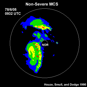
and supercells. However, groups of thunderstorms often join into larger systems,
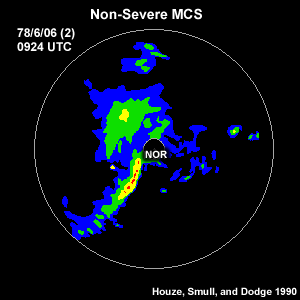
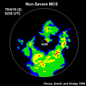
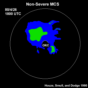
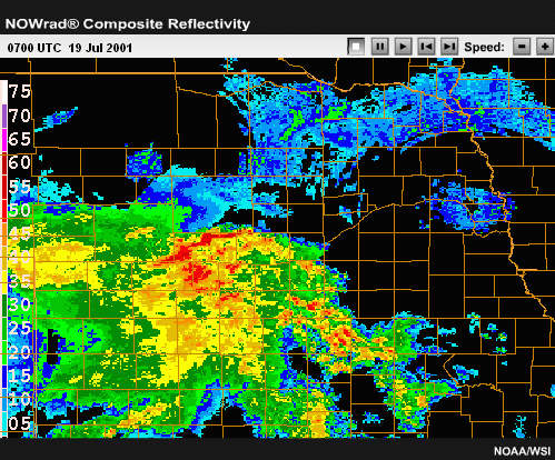
generically referred to as mesoscale convective systems (MCSs). Some of the
classic MCS types include squall lines, bow echoes, and mesoscale convective
complexes, each of which will be discussed individually. MCSs occur worldwide
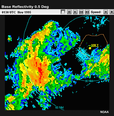
and year round. For example, this radar loop shows an isolated, damage-producing
bow echo that occurred near the island of Kauai, Hawaii in November of 1995.
2.2 Associated Threats

The individual cells within an MCS can be any of the basic storm types mentioned
earlier, depending on the environmental characteristics. In addition to the
severe weather produced by any particular cell within the MCS, these systems
can generate large areas of heavy rain and/or high winds. Large swaths of
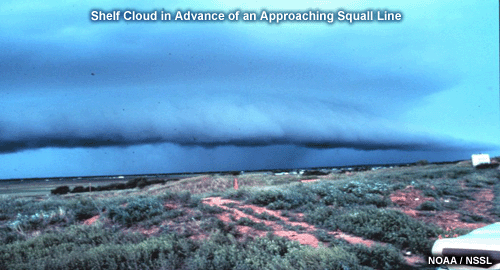
damaging surface winds are a particular concern with bow echoes. One indicator
of strong winds and severe turbulence with MCSs is a shelf cloud. They are
often found on the leading edge of an MCS and may extend more than 100 km
in length.
2.3 MCS Initiation

Click the image above to view animation.
MCSs may evolve from an isolated cell or small group of cells or may be
triggered as a large linear convective system from the onset, such as a squall
line along or ahead of a cold front or along a dryline. This animation shows
storms initiating just east of a dryline near Amarillo, Texas. The storms
quickly create a squall line MCS.
2.5 Factors Influencing MCS Structure

Click the image above to view animation.
Just as the structure and evolution of isolated convection depend on the buoyancy
and vertical wind shear regime in which they are embedded, MCS properties also
depend on the characteristics of the buoyancy and shear profiles. In this module
we examine how the strength and the degree of organization of an MCS increase
with higher magnitudes of ambient vertical wind shear. We will see that the
surface cold pool functions as the most significant unifying force among individual
cells, resulting in MCS formation. The evolution of MCSs is heavily controlled
by the interaction between the system’s mesohigh cold pool and the low-level
vertical wind shear. Since MCSs often last for three hours or more, the Coriolis
effect also has a significant impact on system evolution.
It is very important to note that in this module, our discussions
of the role of shear and the surface cold pool apply to boundary
layer-based MCSs, not elevated convective systems.
Elevated convection is discussed later in this module in the section on Mesoscale
Convective Complexes (or MCCs).
2.6 Section Review Questions:
1. Fill in the blank:
The _______________ functions as the most significant unifying force among
individual cells.
2. Examine the following three radar loops and determine which ones contain
an MCS. (Choose all that apply.)
Radar Example A:

Click the image above to view animation.
Radar Example B:

Click the image above to view animation.
Radar Example C:

Click the image above to view animation.
3. MCSs may:
a) Evolve from a small group of cells
b) Evolve from a single isolated cell
c) Start out as a large linear convective system
d) All of the above
4. Multiple Choice
The most general term for a group of thunderstorms that join together
is:
- a) Mesocyclone
- b) Mesoscale convective system
- c) Supercell
- d) Mesoscale convective complex
2.7 Review Questions Feedback
1. The correct answer is "cold pool."
2. Expert Answer: Radar loops A and C indicate MCS variations in different
stages of evolution. Radar loop B shows scattered airmass thunderstorms over
Utah on a summer afternoon. Although some of these cells have joined into short
lines or clusters, they have not become organized along a common leading edge
and do not yet share a common cold pool. You will learn more about identifying
MCS characteristics in later sections of this module.
3. The correct response is D - all of the above.
4. The correct answer is B. The most general term for describing groups of
thunderstorms that join together into larger systems is "mesoscale convective
system." A mesoscale convective complex is a very specific type of MCS
historically identified by a very large cold cloud top on IR satellite imagery
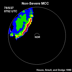
that lasts for a certain duration. Mesoscale convective complexes will be
discussed in more detail later.
End of Section 2: Introduction

