Conceptual Model
A Single Cell signature is used as one of the many signatures that might indicate a severe thunderstorm if the single cell radar echo can be interpreted as a supercell or other dominant, longer–lived elevated core in a moderate to strong deep layer shear environment.
In stronger deep layer shear environments (0–6 km shear exceeding 30–40 knots), single cell signatures may indicate a supercell. Supercells generally can produce all four of the severe convective hazards used to define a severe thunderstorm in Australia. A climatology performed in the US on 2007 events confirmed that supercells produce severe weather more frequently than other morphologies, and also produce more intense severe weather (Duda & Gallus, 2010). Large hail, damaging winds and heavy rainfall are likely to occur. Tornadoes should also be considered, although only about a quarter of supercells are tornadic (Duda & Gallus, 2010)
For more statistics on the likelihood of supercellular severe weather, see the generic Supercell Conceptual Model.
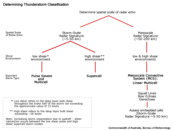
Determining Thunderstorm Classification
To help determine the classification of the thunderstorm you are observing, use the following flow chart to help diagnose which thunderstorm conceptual model you should consider more closely.
A "single cell" signature narrows the underlying thunderstorms classification down to two storm types: Pulse Severe or Supercell. As we are emphasising the steadiness of the single cell signature in moderate to strong deep layer shear, most of the meaningful single cell signatures belong to marginal or fully–fledged supercells.

