Conceptual Model
Identifying a Damaging Low-level Winds signature directly indicates that the thunderstorm is severe. The presence of Damaging Low-level Winds generally suggests a strong downdraft. The most common mechanism for damaging winds is a downburst or microburst where negatively buoyant air with high vertical momentum reaches the surface. Negative buoyancy is primarily generated by evaporation and precipitation loading. In deep layer shear-affected storms, especially in supercells, downdrafts can be enhanced through the additional air parcel accelerations due to dynamically induced vertical pressure gradients.
Other mechanisms that generate damaging surface winds include the downward transfer of high horizontal momentum aloft, usually from a jet , brought down to the surface through a downdraft or vertical mixing.
Finally, very strong surface winds can be created near supercells through large horizontal pressure gradients due to the formation of a storm scale low (low level mesocyclone).
Damaging winds should definitely be included on the warning with upgrades to destructive winds if the surface winds are likely to reach 67 knots or 125 km/hr.
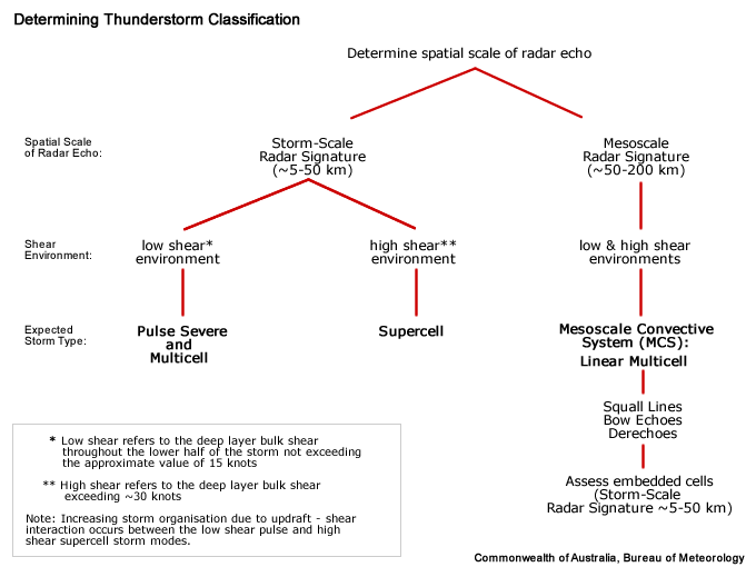
Determining Thunderstorm Classification
Low Level Damaging winds could be produced in all of the conceptual models we have included in this module.
To help determine the classification of the thunderstorm you are observing, use the following flow chart to help diagnose which thunderstorm conceptual model you should consider more closely

