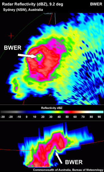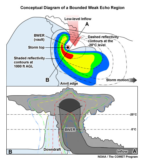

An example of radar images associated with a bounded weak echo region (BWER). The strong updraft of the thunderstorm diverges near the top of the storm. The updraft is strong enough to carry hydrometeors with it, leaving a weak echo region. In this scenario, the strong rotation of the mesocyclone as well as strong vertical wind shear will cause "bounding" of the WER on the side and top.
